
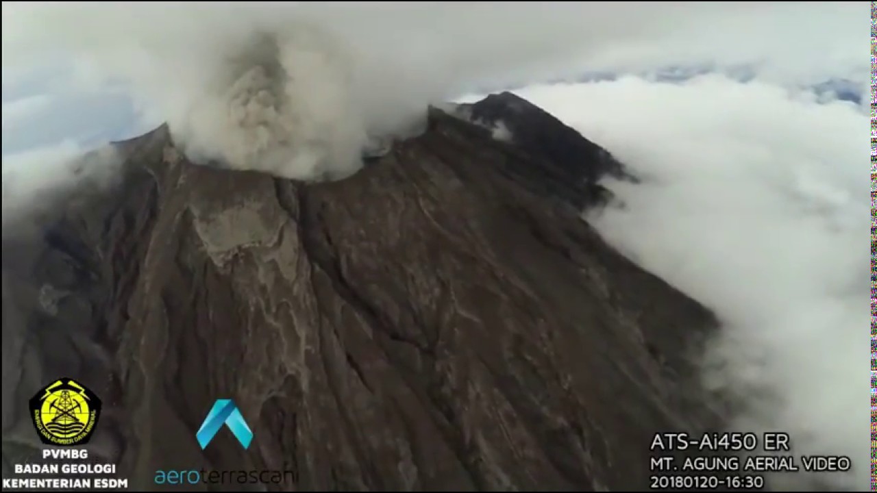
Drone (ATS-Ai450 ER) captured latest condition of Mount Agung crater on 20 January 2018 16:52 localtime (utc+8). Today they’re planning to do another flight.JUST TIME.
Note: Slow Mode Video
Story by @dwicreative :
According to the Flight Director Seno Sahisnu when the weather was really unfriendly, rainy and occasionally seen the peak of Mount Agung decided to fly immediately, but when the drone was about to reach the peak of Mount Agung about 1.5km longer Ai450 drone suffered turbulence strong enough and dangerous until the drone suddenly descending altitude up to 150meter, estimated due to air pressure from surrounding clouds at the peak of Mount Agung, with such condition Flight Director Seno Sahisnu decided to abort the mission, or drone in pull back home, it turns out after the visual file in Mount Agung computer checks Have eruption and if drone to enter in a cloud of volcanic smoke will be very dangerous for the drone machine, here’s the visual.
Video Owner:
Aeroterrascan
ESDM & PVMBG
Related Posts
")
DRONE FPV RACING PRACTICE (Caddx)

3D Printed Racing Drone – Will It Survive?

Mikey’s First Drone Race – Extended Version

RC RENO AIR RACER UNLIMITED

When Animals Chase DRONES..Who ends up in the DOG HOUSE? MAIL- 100

masih erupsi..