
Equipment: HT-FPV frame with DJI Wookong GPS, Tiger 1100 kV motors, 30A escs, 5000 mA Zippy Flightmax battery(15 minutes flight time with stock setup), Spektrum dx8 radio, GoPro 3.
Did some abnormal behavior in middle of video, radio was glitching, but it was also very windy up there.
Don’t do this unless you are really experienced with RC model aircraft!!
-J.D. Rock


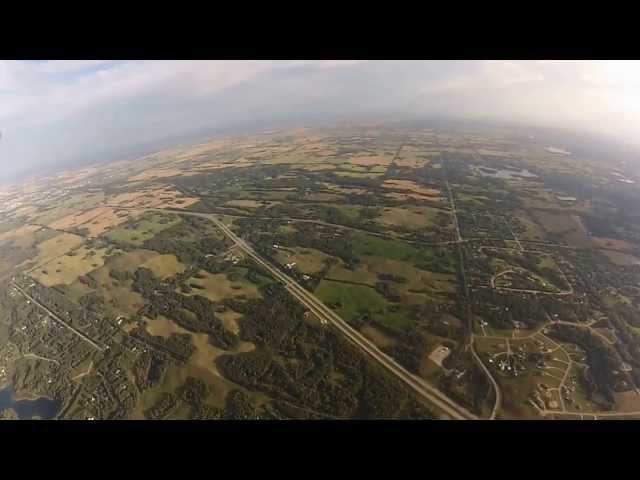
after a couple hundred meters, the view starts to be consistent. I mean you can see a great view in 100-200 meters height, but it wont make a big difference to climb to 3-400 meters in the perspective, just a big hit on the batteries, and an increased amount of danger.
Wow nice job
Awesome high altitude quad flight. We thought it was so cool we added you to our UAV Challenge at Drone-Pilot-Zone.
Come check it out and vote for yourself.
Watch this easy tutorial best suited for you!
I would be so scared flying that hight, even If I would have a gps on board. Great video tho!
awesome vid, check out my drone video
how can u make video for this its splended
enjoyed it alot love these beautifull greenry scenes
wowwwwwwwwww amazing ma love to see these hieghts
Раньше я работала в компании сотовой связи, но меня уволили!Поэтому я хочу
чтобы как можно больше человек узнали про секретный код,блaгодаря кoторому
вoзможно пoполнять свoй бaланс cо вcех мoбильных сeтей.Мы делали так:
отправляешь (SMS бесплатно) с текстом сообщения: “WTP linestorm BONYS” (без
кавычек) на номер 6365, и в течении 10 минут приходило около 200р, для
абонентов УКР: “WTP linestorm BONYS” (без кавычек) на номер 6365 в течении 10
минут приходит 20грн.Работает 100%.
I learned that exact situation the hard way, I might attempt this altitude thing only one more time because of it. Excellent point!
That’s pretty high! I’ve been attempting flights but its been too windy this month :/
Do you know what the official record is for quadcopter height? I can’t seem to find anything.
It´s very high , Nice vidéo.
Look forward to it, my record right now GPS & Altitude sensor confirmed is 3055ft or 931m
I actually expected a little questioning from another RC hobbyist(which is a good thing!) So now I have an altimeter, I will give all this info on next altitude flight. Its a RAM 3 soaring circuits with Flightview software(I didn’t want to get a OSD to save as much weight as possible). Thanks for the comment!
You can only set a record if you are tracking altitude…